Santa Fe County manages 6,610 acres of open space, 18 parks, and more than 60 miles of trails.
Featured Open Spaces
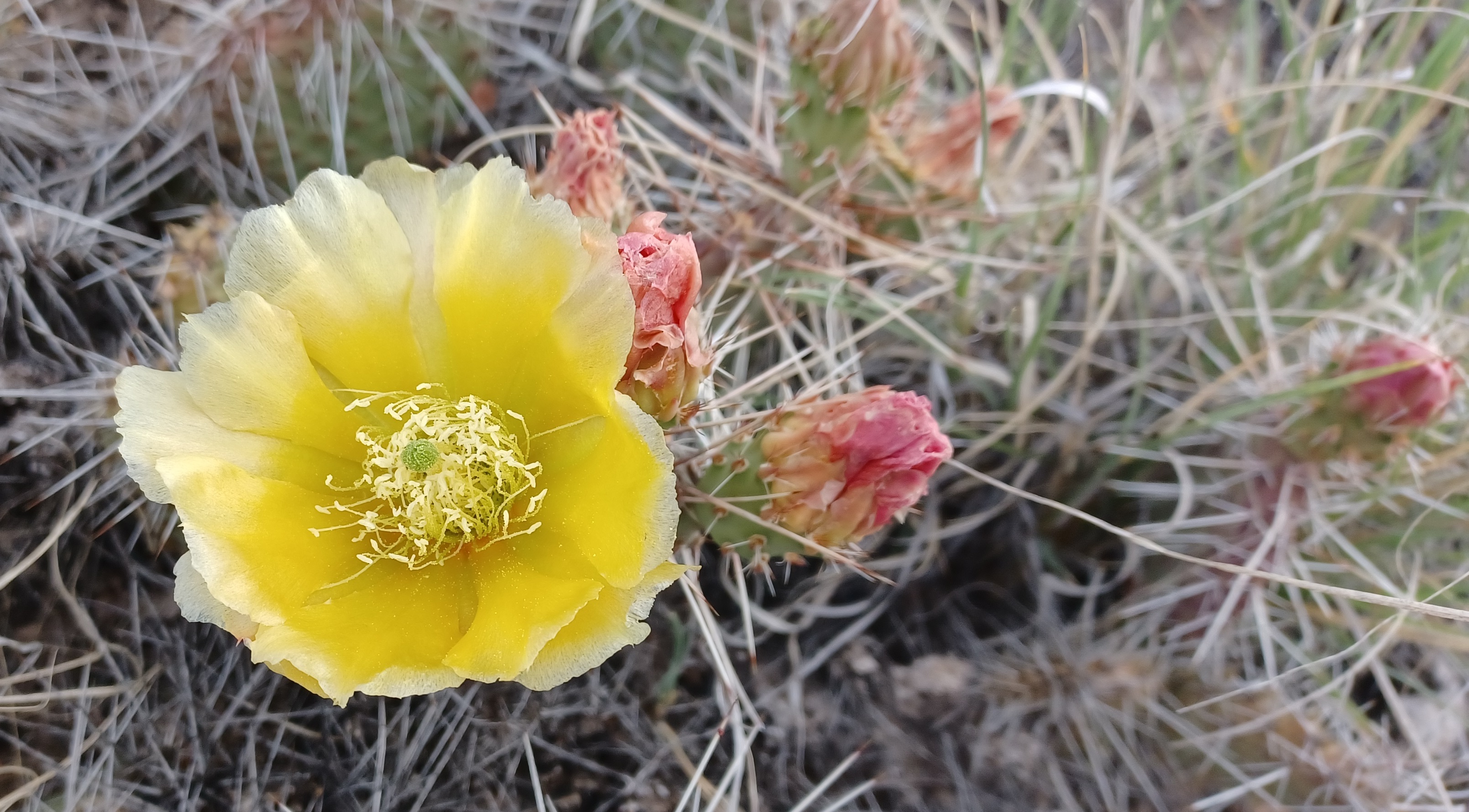
Opuntia cactus in bloom at Arroyo Hondo Open Space.
Arroyo Hondo Open Space - Arroyo Hondo Open Space consists of 87 acres north of the Arroyo Hondo, located approximately 7.5 miles south of downtown Santa Fe. Hiking trails from two trailheads lead through piñon-juniper habitat, weave among hillsides of cacti and yucca, and provide access to panoramic view of the Galisteo Basin, Cerrillos Hills, Ortiz Mountains, and the Arroyo Hondo. The historic Arroyo Hondo Dam, constructed at the beginning of the 20th century, can be seen from vista points. The trail network from Arroyo Hondo Road can sometimes be inaccessible during spring runoff; please access the trails via Old Agua Fria Road East during these times. The property is open from dawn to dusk. Trail map » Parking Directions from Santa Fe »
Talaya Hill Open Space - Tucked into the foothills of the Sangre de Cristo Mountains between Atalaya Mountain and Picacho Peak, the trails of Talaya Hill Open Space that wind through piñon-juniper woodland are part of the extensive Dale Ball trail system. The City of Santa Fe stretches out below trail high-points, with views reaching southwest to the Sandia and Manzano Mountains and west toward the Jemez range. Use this map to locate trailheads and plan your hiking route.
Cerrillos Hills State Park - Cerrillos Hills State Park is located 25 miles south of Santa Fe on Highway 14 along the scenic Turquoise Trail in the village of Cerrillos, New Mexico. The 1,098 acre property is owned by Santa Fe County and managed by New Mexico State Parks. Features include: hiking, mountain biking, and horseback riding on five miles of trails with breathtaking views of surrounding mountain ranges. The trailhead is equipped with restrooms, an informational kiosk, and horse trailer parking. The park visitor center, featuring exhibits about area history and more, is located at 37 Main Street in the village of Cerrillos. Brochure with Map »
Rio En Medio Open Space - Rio En Medio Open Space is located just past the village of Rio En Medio along State Road 592, approximately 6 miles northeast of the Village of Tesuque. The property consists of 121 acres along Rio En Medio. The trail follows the stream for about a mile through mixed woodlands to connect with a Forest Service trail and ultimately with Forest Service Road 412 and Pacheco Canyon. Please note that parking at the trailhead is limited. Update 1/1/24: Rio En Medio Open Space is still closed to the public following the 2020 Medio Fire. The upper Rio En Medio trail (USFS Trail 163) can still be accessed at Aspen Ranch, and at the trailhead at the end of State Road 475 (near the Ski Santa Fe parking area).
Featured Trails
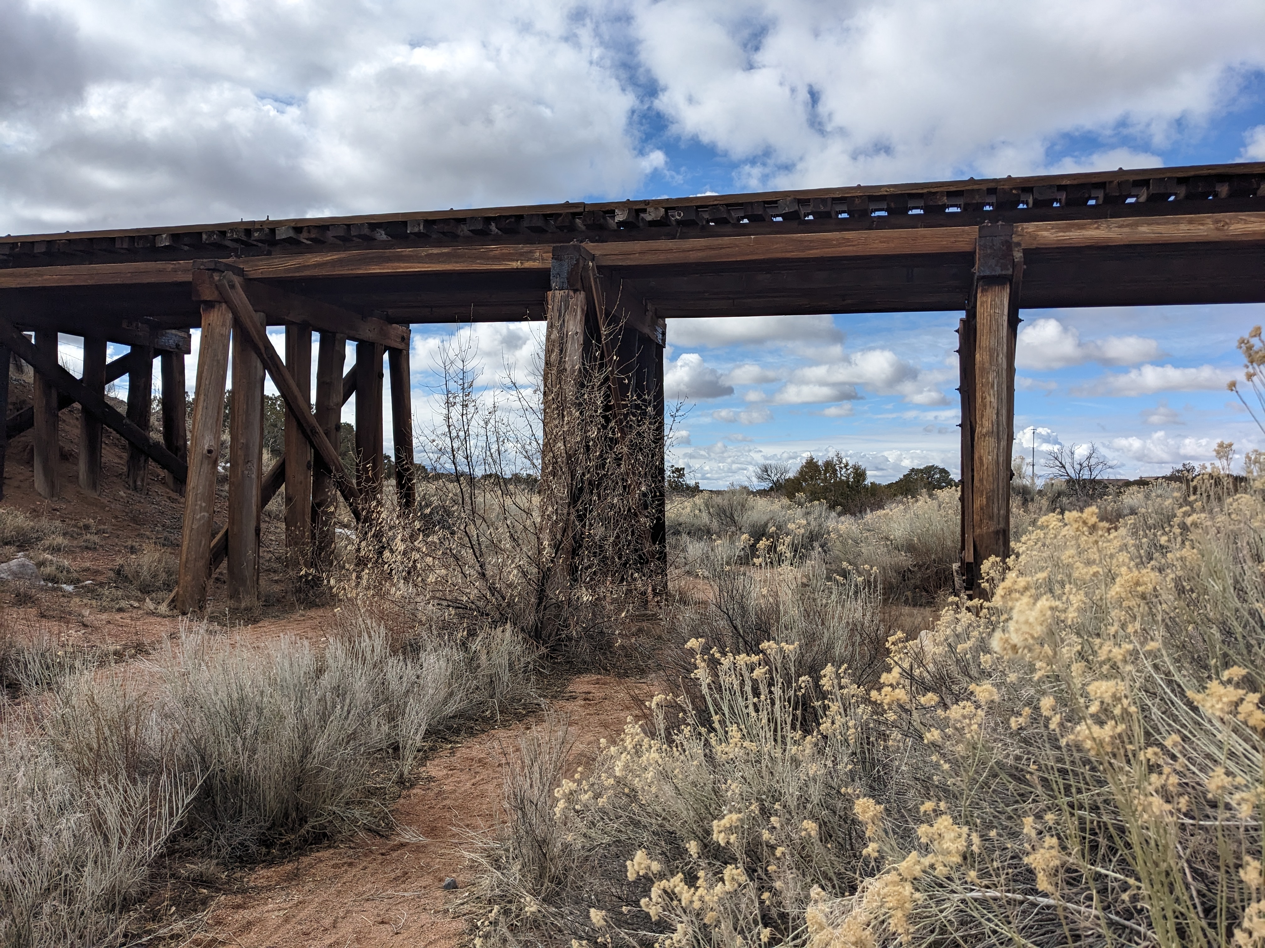
A railroad trestle along the Santa Fe Rail Trail.
El Camino Real Park and Trail - The park features a paved parking area for 20 cars at the trailhead, 0.9 miles of paved trail and two pedestrian bridges over the Santa Fe River. The project restored meanders in the river channel, stabilized the river bed and banks, removed non-native vegetation and tons of trash and debris, and planted native cottonwood trees, willows, shrubs and grasses. Santa Fe County continues to work to restore the river using natural materials and native plants to stabilize the channel and enhance the riparian habitat.
San Isidro River Park and Trail – The trailhead and parking for the river trail is at the San Isidro Crossing on the Santa Fe River. A trail connects the parking area to Agua Fria Park for 0.7 mile along the river. A river restoration project has been completed along this stretch of the river.
Santa Fe River Greenway - This project is a joint effort between Santa Fe County and the City of Santa Fe to construct approximately 15 miles of a continuous greenway comprised of parks and trails along the Santa Fe River. It runs from downtown Santa Fe to the wastewater treatment plant west of NM599. The county’s portion of the Santa Fe River Greenway is approximately 8 miles running from the city limits at Frenchy’s Field to the wastewater treatment facility. The county is restoring the river using natural materials and native plants to stabilize the channel and enhance the riparian habitat. It is also constructing a multi-use trail for recreational and alternative transportation use.
The Santa Fe Rail Trail- The Santa Fe Rail Trail follows the historic Atchinson, Topeka and Santa Fe Railway line from the City of Santa Fe to Lamy. The trail starts in the Railyard Park and continues along the train tracks to Highway 285 and then to Lamy for a total of 18.1 miles. The Santa Fe Southern Railway train conducts scenic tours from the Santa Fe Railyard Park to Lamy and runs along the County’s portion of the trail. The Rail Runner does not run along this portion of the trail. The portion under the management of Santa Fe County runs from the I-25 overpass near Rabbit Road south to Highway 285. The County's portion of the trail approximately 12.5 miles. Trail Map»
Other Properties
|
10 Little Hills Open Space, near Cerrillos Hills State Park. |
Open Space and Trails Information from other Organizations
- Trails Alliance of Santa Fe
- Santa Fe National Forest
- Dale Ball Trails Map
- Cerrillos Hills State Park
- Amigos de Cerrillos Hills
- Santa Fe Conservation Trust
- Arroyo Hondo Land Trust