Santa Fe County Open Space, Trails, and Parks manages 9,400 acres of open space, 18 parks, and more than 65 miles of trails.
While spending time in these special places, please follow Santa Fe County's basic Rules & Regulations to ensure the enjoyment of others and to help preserve and protect our fragile ecosystems. Learn important tips for "Treading Lightly" by reviewing this brochure.
Dogs must remain on-leash at all Santa Fe County Open Space & Trails properties, unless signage indicates otherwise. If you are looking for off-leash options, consider taking your dog to the 138-acre Santa Fe Dog Park.
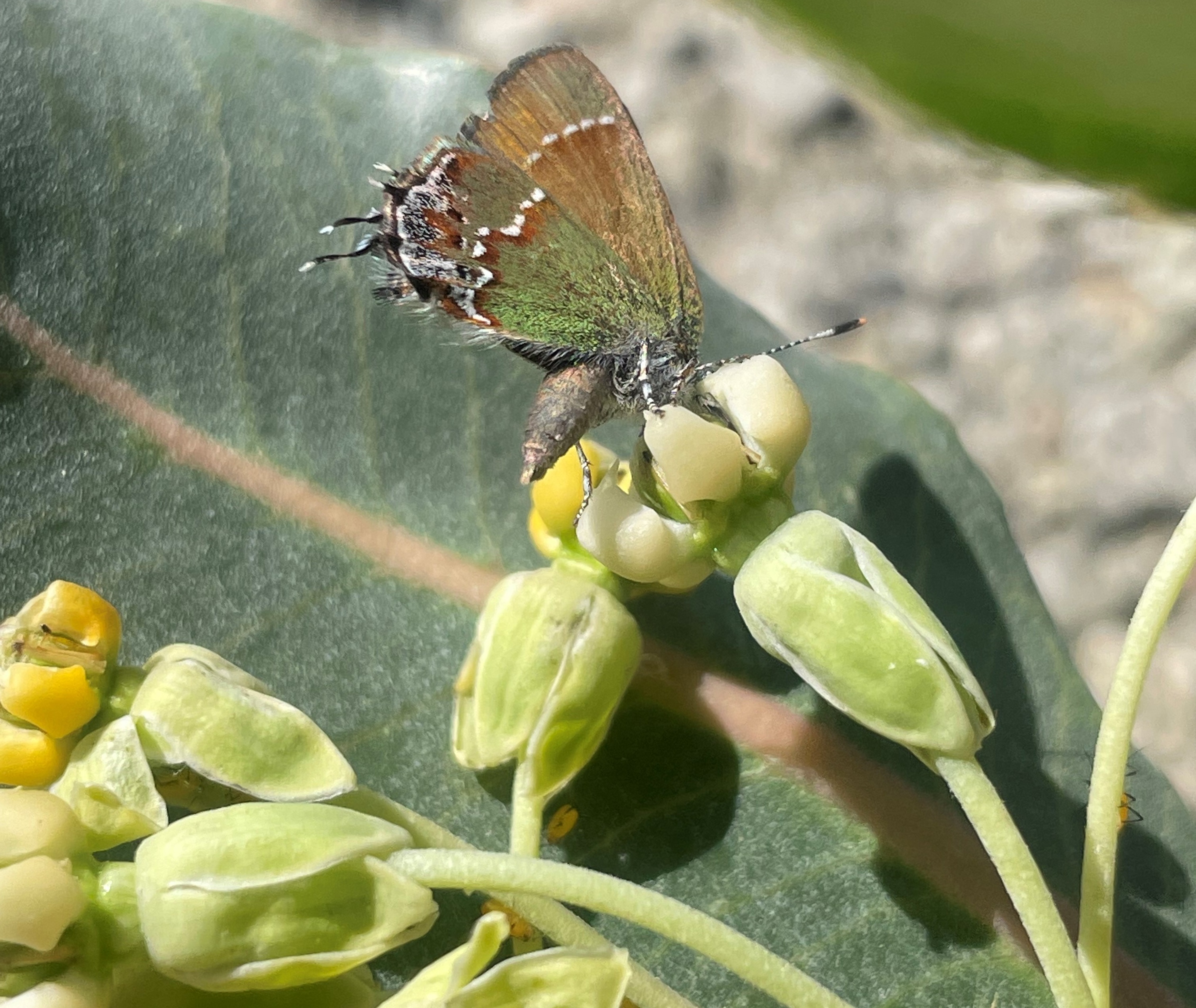
A Juniper Hairstreak butterfly (Callophrys gryneus) collects pollen
from a Broadleaf Milkweed (Asclepius latifolia) at 10 Little Hills Open Space.
Open Space Wildlife
Santa Fe County's Open Spaces are home to a great number of animal species, many of whom we rarely see. Staff in the Open Space and Trails program has installed wildlife cameras that enhance monitoring efforts to support wildlife and open a window into the lives of the many wild creatures of Santa Fe County. Click here or on the image below to enjoy this selection of wildlife photos from across our open spaces.
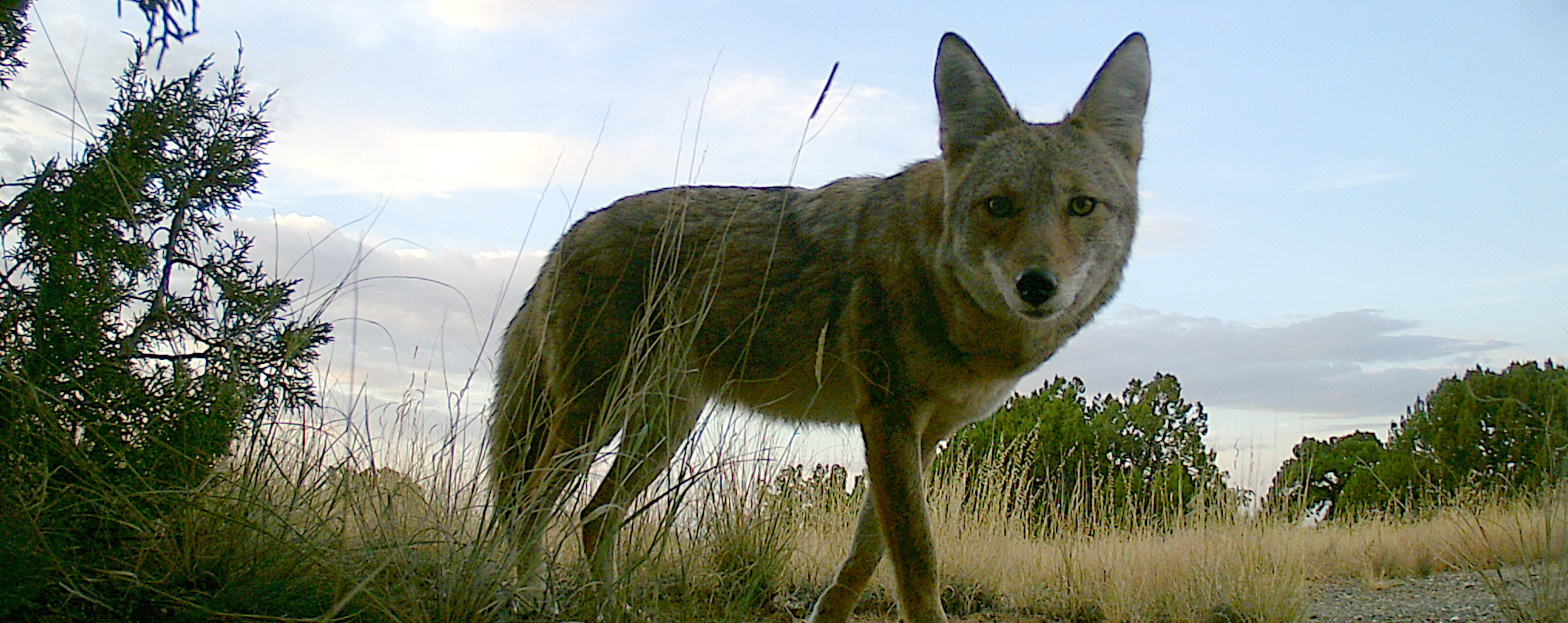
What should you do if you see a wild animal?
Keep your distance and do not approach. Never feed a wild animal.
Wild animals who become habituated to humans are less likely to survive.
Always remember: our favorite trails and open spaces are wild animals' homes.
Featured Open Spaces
|
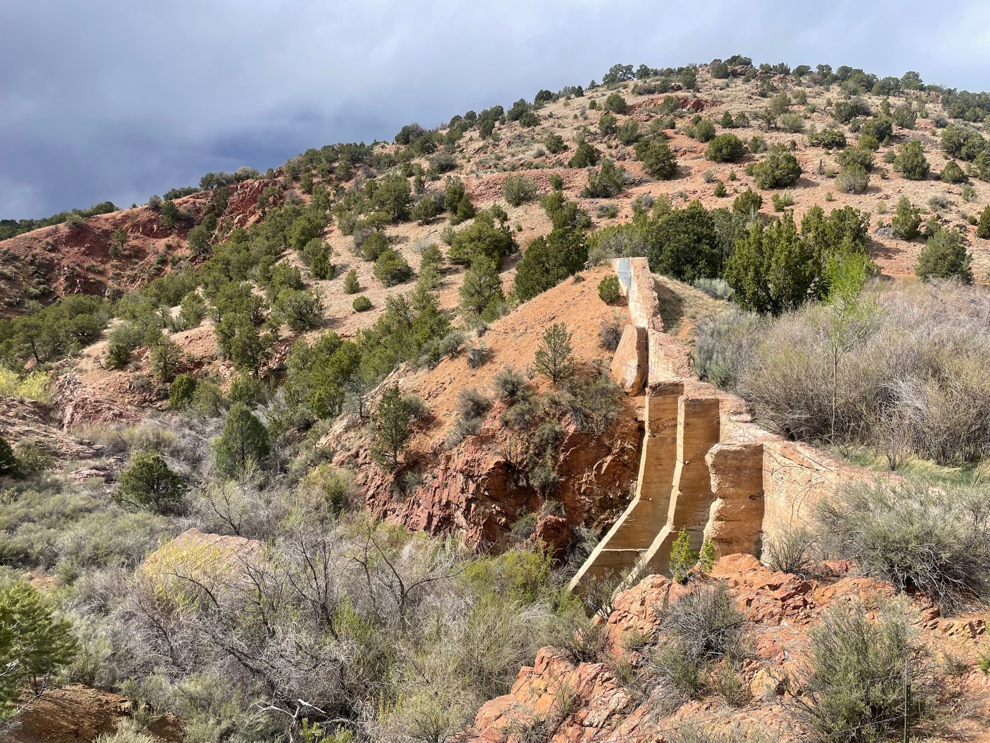
Arroyo Hondo Open Space Arroyo Hondo Open Space consists of 87 acres along the Arroyo Hondo, located approximately 5 miles south of downtown Santa Fe. Hiking trails from two trailheads wind through piñon-juniper habitat, weave among hillsides of cacti and yucca, and lead to panoramic views of the Galisteo Basin, Cerrillos Hills, Ortiz Mountains, the Arroyo Hondo, and more. The historic Arroyo Hondo Dam No. 2, constructed at the beginning of the 20th century, can be seen from vista points. The trail network from Arroyo Hondo Road can sometimes be inaccessible during spring runoff; please access the trails via Old Agua Fria Road East during these times. The property is open from dawn to dusk. Parking Directions from Santa Fe » Learn which species of cacti grow at Arroyo Hondo Open Space with this two-sided handout. Print or save to a device of your choosing to carry with you on a hike. |
The Santa Fe Irrigation and Improvement Company funded construction of Arroyo Hondo Dam No. 2 between 1908 and 1912 as part of a large development scheme intended to harness the capricious waters of the Arroyo Hondo with three dammed reservoirs. Capitalists backing the plan dreamed of irrigating 5,500 agricultural acres south of Santa Fe and developing two new suburban communities to be named Glenview and Bethlayne. Though acclaimed by financiers and local politicians, the Arroyo Hondo project was plagued by false starts and slow progress. Built from poured concrete, this dam was still not complete when a flash flood destroyed it on July 15, 1912, resulting in the project's abandonment. |
|
Talaya Hill Open Space Tucked into the foothills of the Sangre de Cristo Mountains between Atalaya Mountain and Picacho Peak, the trails of Talaya Hill Open Space that wind through piñon-juniper woodland are part of the extensive Dale Ball trail system. The City of Santa Fe stretches out below trail high-points, with views reaching southwest to the Sandia and Manzano Mountains and west toward the Jemez range. Use this map to locate trailheads and plan your hiking route. |
One of the trails leading down from Picacho Peak through Talaya Hill Open Space. |
|
Cerrillos Hills State Park Cerrillos Hills State Park is located 25 miles south of Santa Fe on Highway 14 along the scenic Turquoise Trail in the village of Cerrillos, New Mexico. The 1,098 acre property is owned by Santa Fe County and managed by New Mexico State Parks. Recreational opportunities include hiking, mountain biking, and horseback riding on five miles of trails with breathtaking views of surrounding mountain ranges. The trailhead is equipped with restrooms, an informational kiosk, and horse trailer parking. The park visitor center, featuring exhibits about area history and more, is located at 37 Main Street in the village of Cerrillos. Learn more about this incredible landscape from Amigos de Cerrillos Hills State Park. |
Santa Fe-based poet Haniel Long, gazing toward the Cerrillos Hills in 1925, wrote, Photo courtesy New Mexico Energy, Minerals, and Natural Resources Department. |
|
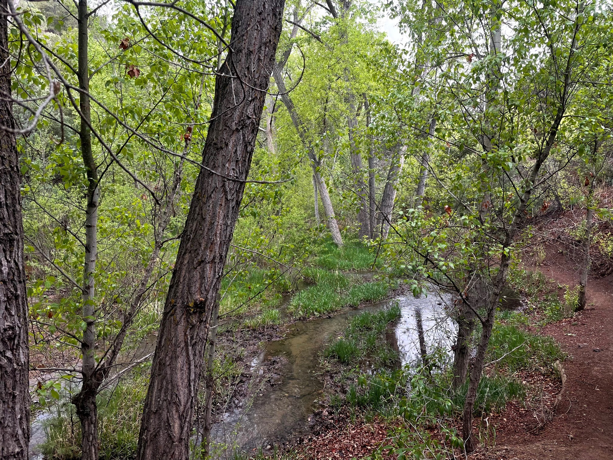
Little Tesuque Creek Open Space and Arroyo de la Piedra Open Space Access the riparian zone of Little Tesuque Creek just after Nun's Corner on Hyde Park Road. Look for a small parking area on the south side of the road; take care crossing safely to access the trailhead on the north side. This trail follows Little Tesuque Creek to the west down a shaded canyon of mature cottonwoods, and connects at multiple junctions with the Windsor Trail System (US Forest Service). The far west end of the trail connects to the steep, uphill Arroyo de la Piedra trail, which rises to a hilltop with views of Tesuque Valley, Pojoaque, and the Jemez Mountains. If you continue south along the trail through Arroyo de la Piedra Open Space, the trail connects to the Dale Ball Trail System and Sierra del Norte Trailhead (City of Santa Fe). Use this map to locate trailheads and navigate these trails. |
Little Tesuque Creek's shady riparian canyon is a cool respite from summer heat. |
|
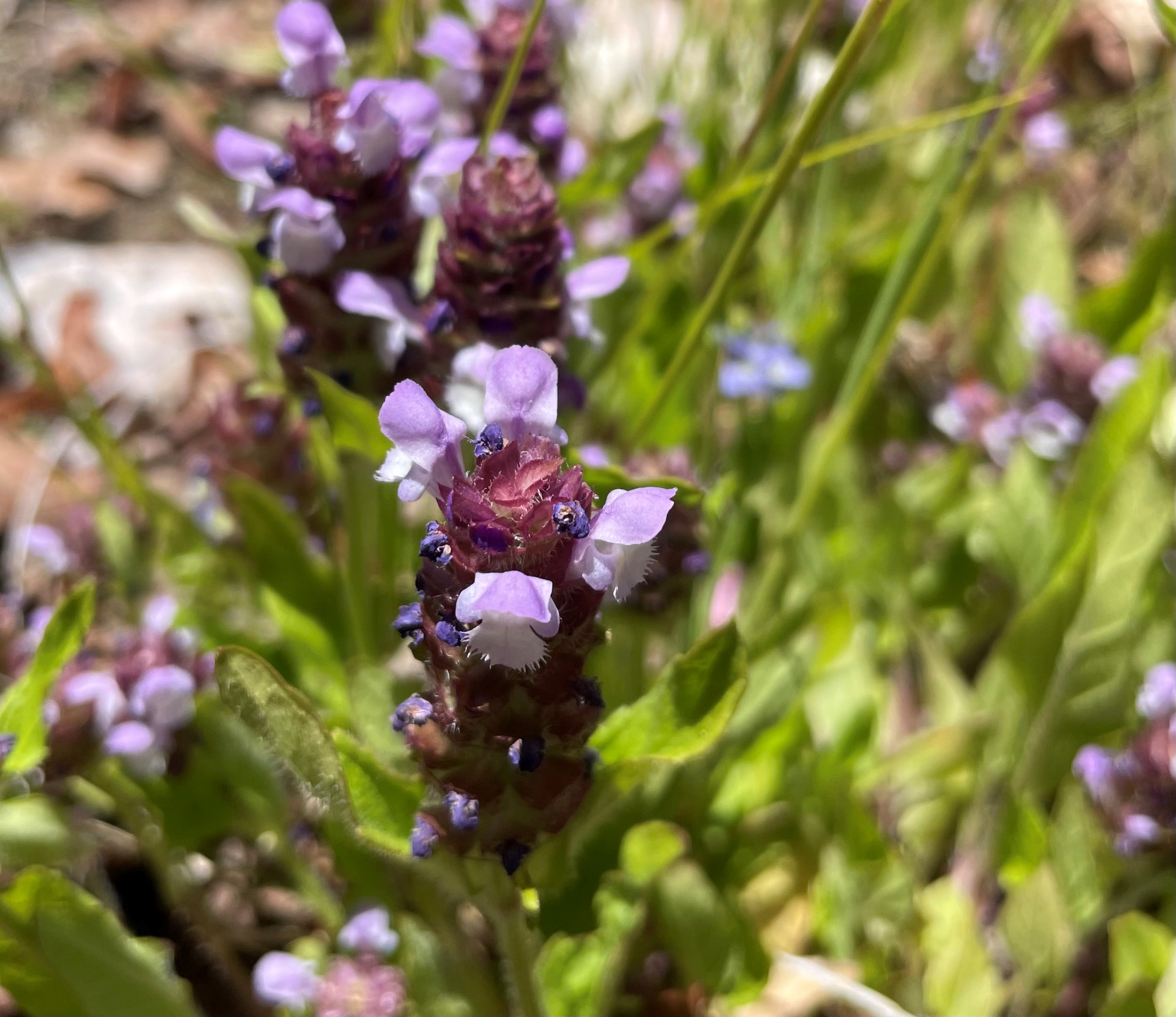
Rio en Medio Open Space Rio en Medio Open Space is located just past the village of Rio en Medio along State Road 592, approximately 6 miles northeast of the Village of Tesuque. The property consists of 121 acres along Rio en Medio. The trail follows the stream for about a mile through mixed woodlands to connect with a Forest Service trail and ultimately with Forest Service Road 412 and Pacheco Canyon. Please note that parking at the trailhead is limited. The upper Rio en Medio trail (USFS Trail 163) can still be accessed at Aspen Ranch, and at the trailhead at the end of State Road 475 (near the Ski Santa Fe parking area). |
Heal-All (Prunella vulgaris) in bloom in Rio en Medio Open Space. |
|
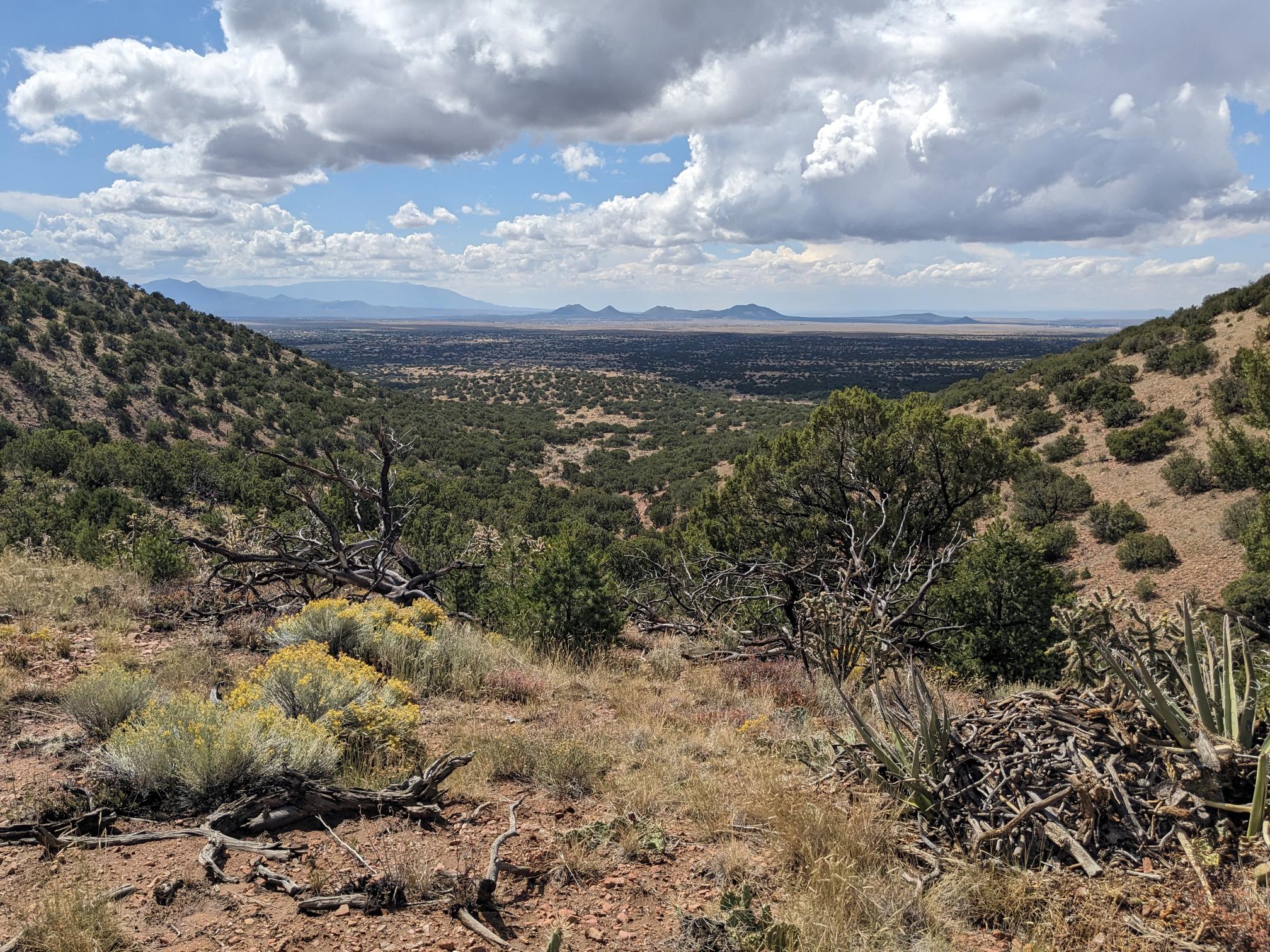
Bobcat Crossing Ranch Open Space The newest Santa Fe County Open Space was acquired on October 9, 2025. With piñon-juniper woodland, rolling hills and grasslands, this 2,650 acre property south of Santa Fe is bordered to the east by I-25, and to the west by 2 miles of the Southern Santa Fe Railway and multi-use Santa Fe Rail Trail. The County will now begin developing a property management plan and master plan for passive recreation trails. |
One of the long views looking southwest from the new Bobcat Crossing Ranch Open Space, with Cerrillos Hills centered in the distance. |
|
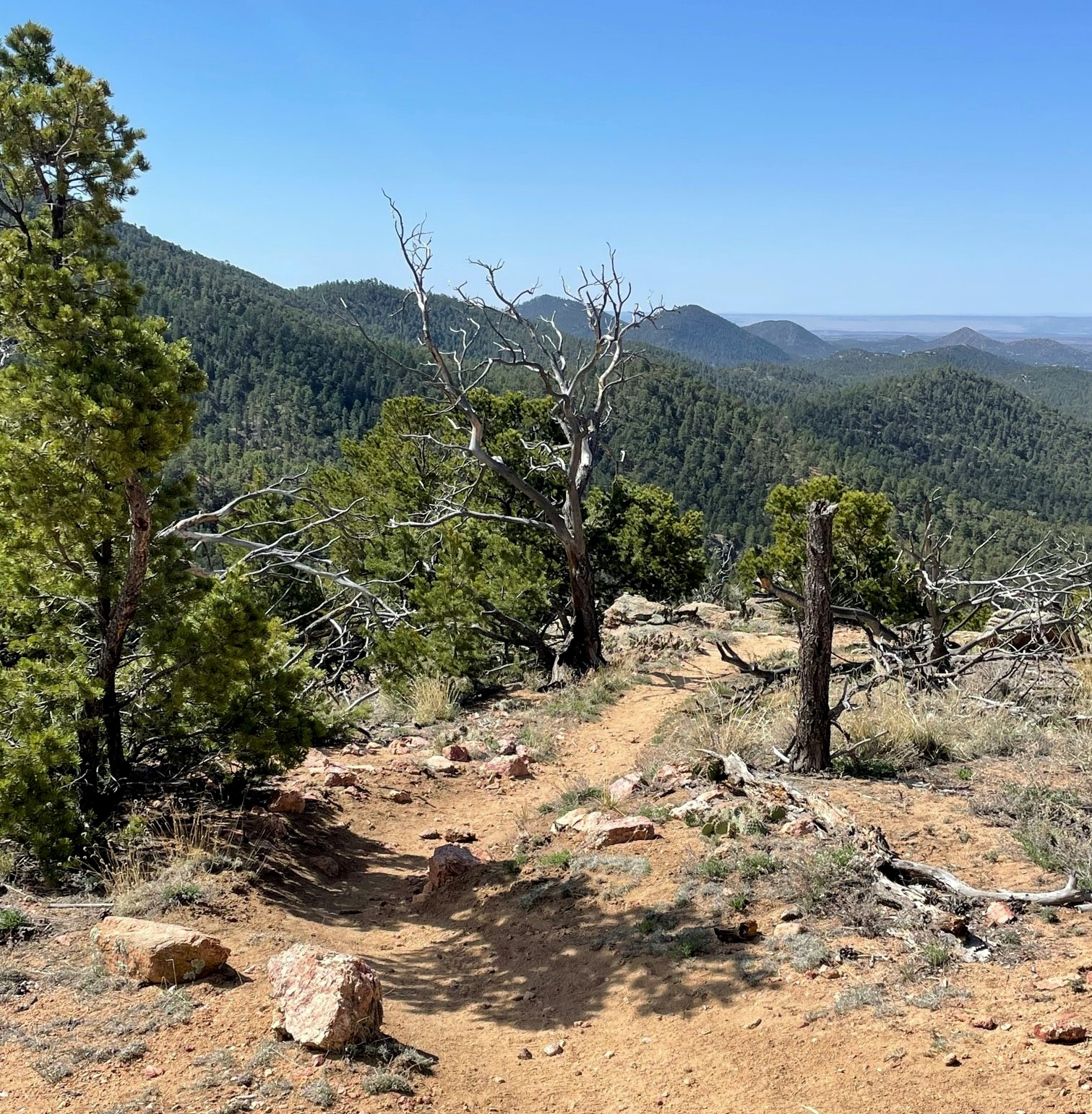
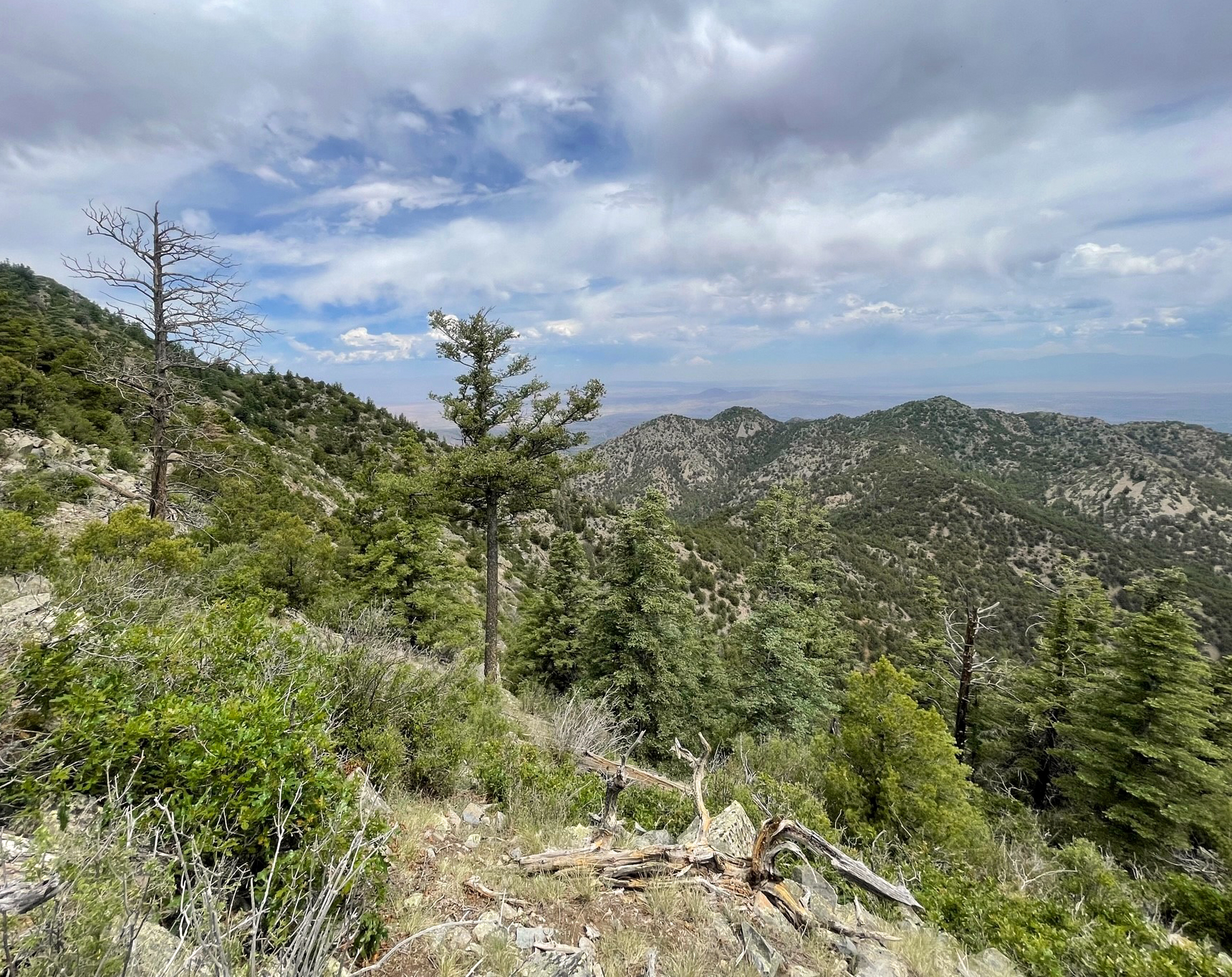
Ortiz Mountains Open Space This 1,350 acre preserve encompasses the upper reaches of the Ortiz Mountains -- about 30 miles southwest of Santa Fe -- including Placer Peak, the highest peak in the range at 8,897 feet. The property is biologically diverse, contains many wildlife species of conservation need, and is part of the Galisteo Basin wildlife corridor. It also contains many historic mining resources, including the Old Ortiz Mine which is one of the earliest hard-rock mines in the western United States. Access to the Ortiz Mountains is through an active gold mine reclamation site, and is not open to the public. County staff are developing plans for guided public hikes, dependent upon road and trail safety improvements. |
Looking northwest from the approach up Placer Peak in the Ortiz Mountains. |
Featured Trails
|
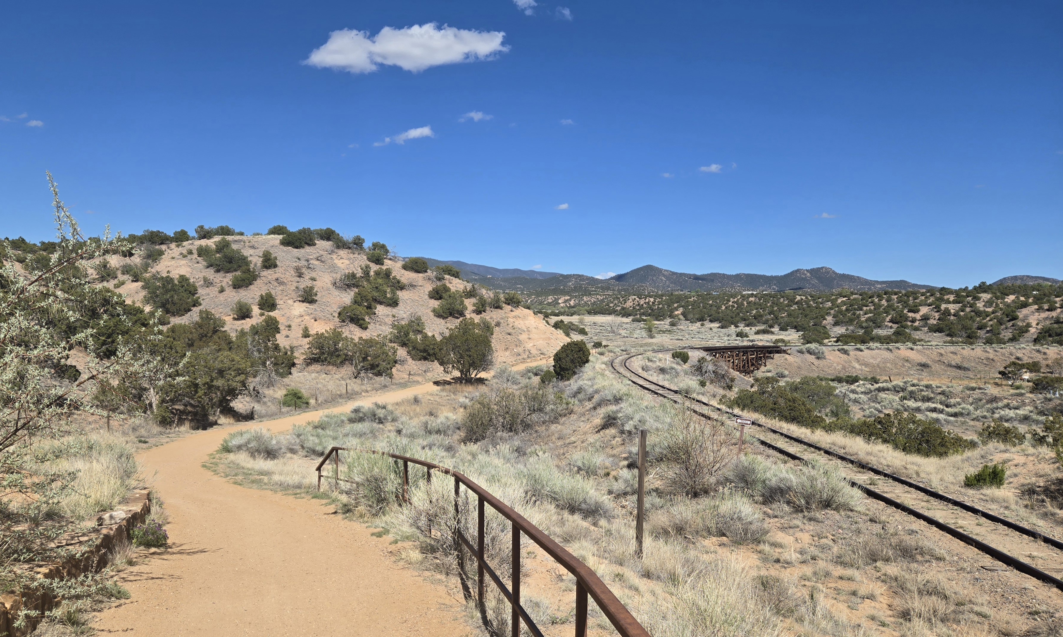
Santa Fe Rail Trail and Spur Trail The Santa Fe Rail Trail follows the historic Atchinson, Topeka and Santa Fe Railway line from Santa Fe Railyard Park to Lamy. The City of Santa Fe manages the first section of the trail, from Railyard Park to the I-25 overpass near Rabbit Road. Santa Fe County manages the remaining 12.5 miles of trail south to Lamy. Trail users may see the Santa Fe Southern Railway train, which conducts scenic train tours along this route. The Santa Fe Rail Trail connects to the Spur Trail 1.78 miles south of Rabbit Road Trailhead. Follow the Spur Trail west, through piñon-juniper grasslands, to connect with the Santa Fe Community College District. |
The Santa Fe Rail Trail crosses Arroyo Hondo south of the Rabbit Road Trailhead. |
||
|
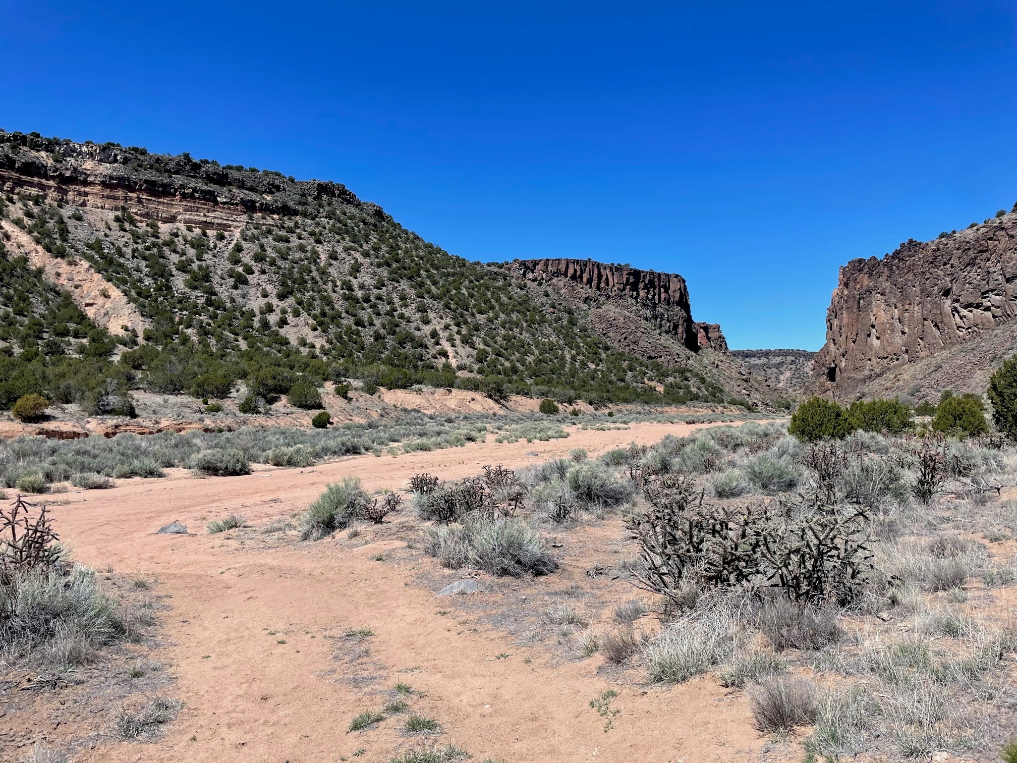
El Camino Real Trail The trailhead features a paved parking area for 20 cars on Constellation Drive, interpretive exhibits, and two pedestrian bridges over the Santa Fe River. El Camino Real Trail extends north for 14 miles to Diablo Canyon. The first 4.5 miles from Constellation Drive trailhead to County Road 62 is paved, while the remainder of the trail is dirt. Bicyclists, pedestrians, and equestrians will see a variety of interpretive exhibits along the trail. |
El Camino Real Trail leads from Constellation Drive trailhead in Santa Fe to Diablo Canyon (above). |
|
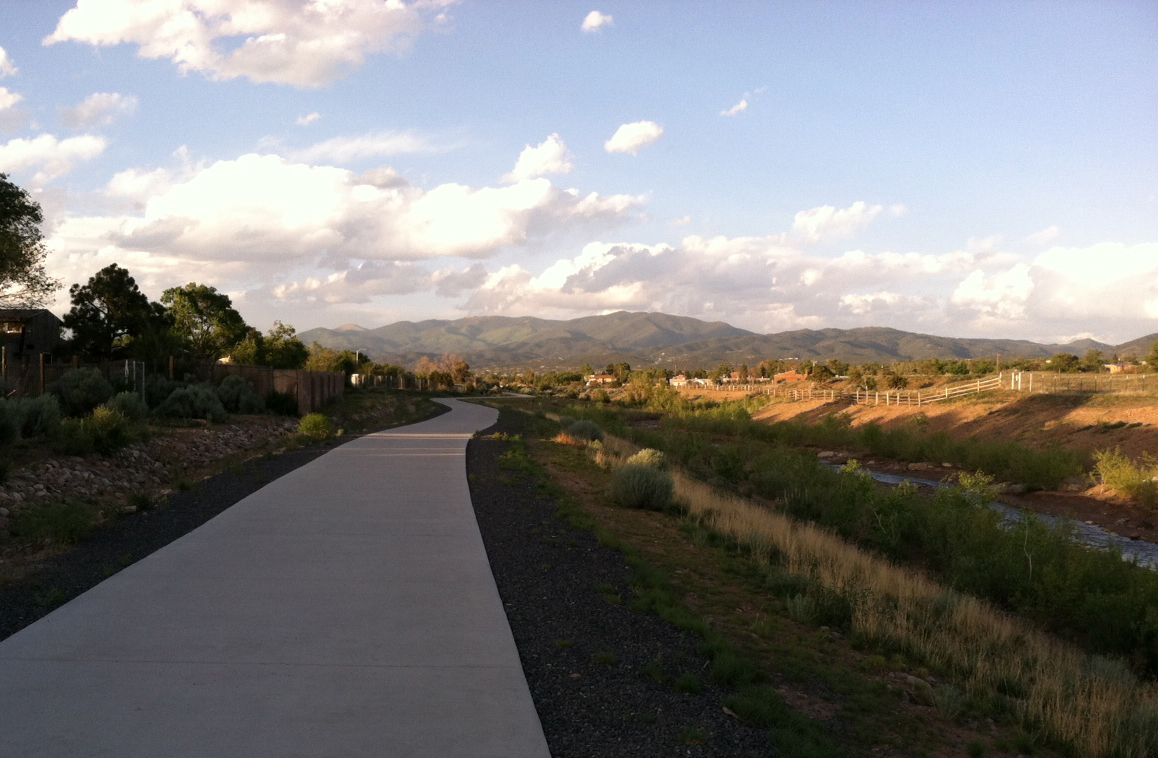
Santa Fe River Greenway This project is a joint effort between Santa Fe County and the City of Santa Fe to construct approximately 15 miles of a continuous greenway comprised of parks and trails along the Santa Fe River. The County’s portion of the Santa Fe River Greenway is approximately 8 miles running from the city limits at Frenchy’s Field to the wastewater treatment plant west of NM599. The county is restoring the river using natural materials and native plants to stabilize the channel and enhance the riparian habitat. It is also constructing a multi-use trail for recreational and alternative transportation use. |
The Santa Fe River Greenway, shown here east of Siler Road provides a beautiful and safe alternate route into downtown on foot or bicycle. |
Other Properties
|
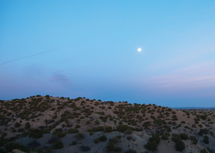
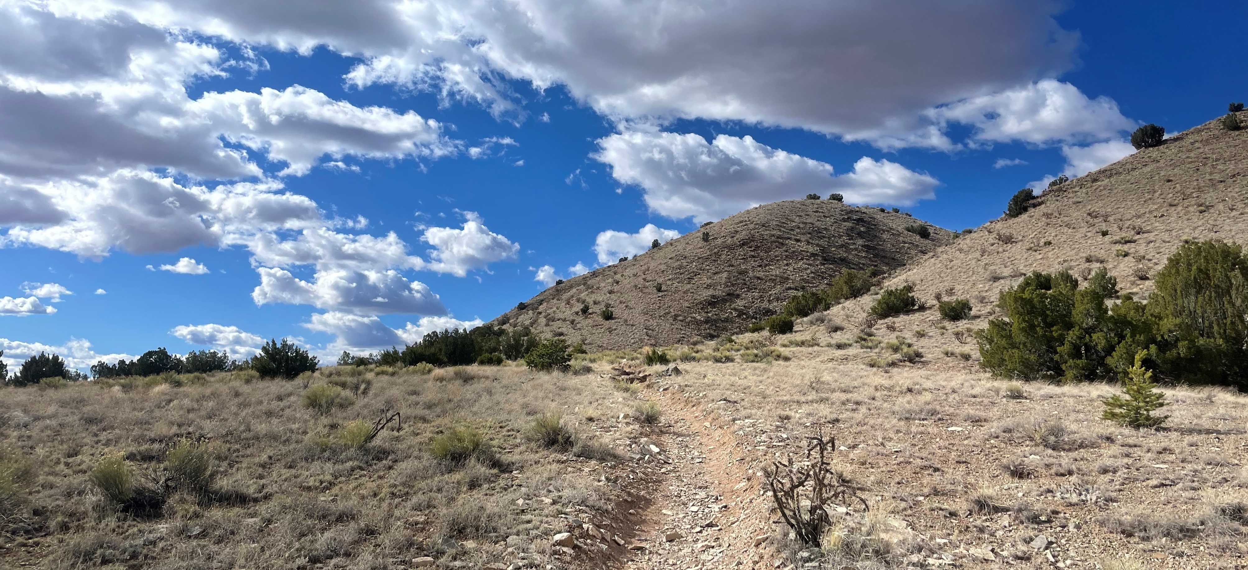
10 Little Hills Open Space, near Cerrillos Hills State Park. |
Open Space and Trails Information from other Organizations
- Trails Alliance of Santa Fe
- Santa Fe National Forest
- Dale Ball Trails Map
- Cerrillos Hills State Park
- Amigos de Cerrillos Hills
- Santa Fe Conservation Trust
- Arroyo Hondo Land Trust